Troup County added to NWS’ moderate risk area for severe weather
Published 9:16 am Sunday, April 12, 2020
|
Getting your Trinity Audio player ready...
|
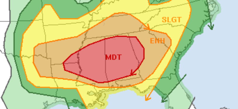
The latest update from the National Weather Service’s Storm Prediction Center has moved the “moderate” area for severe weather further east and now includes Troup County.
Moderate is four out of five on the NWS’ severe weather scale.
“An outbreak of severe thunderstorms is likely today into tonight, with the greatest threat expected from Mississippi across Alabama into western Georgia. Strong tornadoes, widespread damaging winds, and large hail are all possible,” SPC said on its website.
The timing for the severe weather is supposed to be Sunday afternoon into Monday morning.
We will provide more information as it becomes available.