White Christmas? LaGrange could see wintry mix, but snow unlikely for now
Published 3:38 pm Monday, December 21, 2020
|
Getting your Trinity Audio player ready...
|
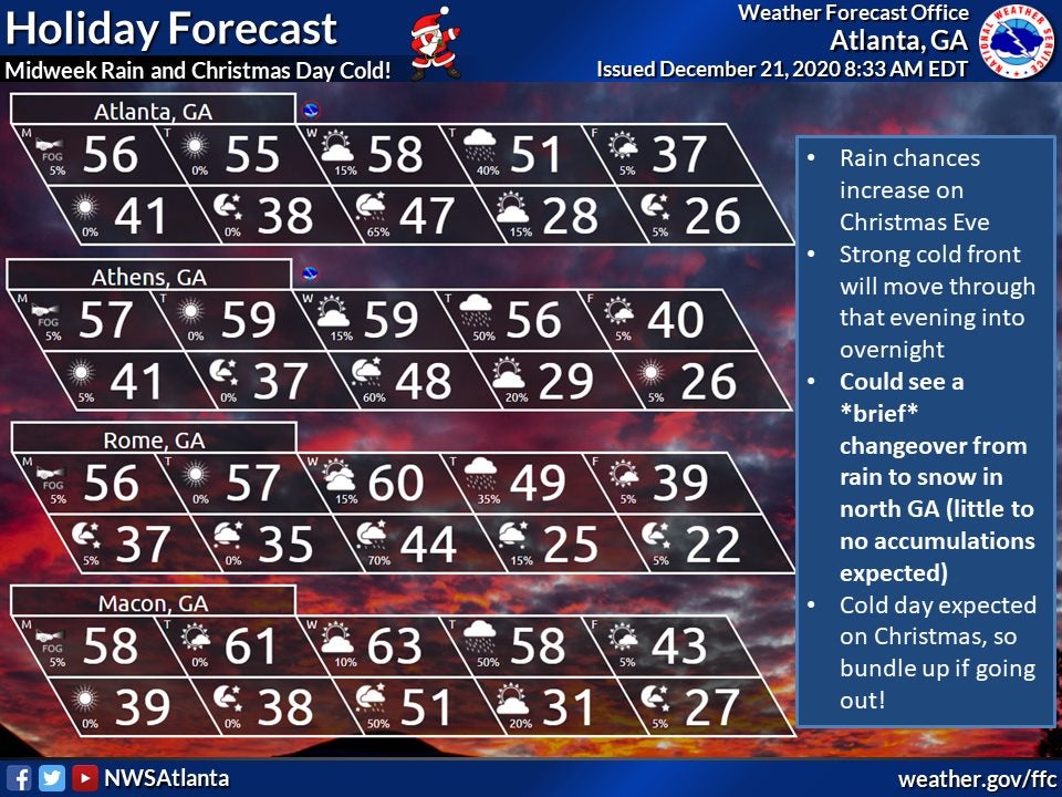
A storm system and a cold front are expected to roll through Georgia later this week, raising the prospect of a white Christmas.
Based on current models, however, snow accumulation in LaGrange is unlikely, according to Sid King, a meteorologist with the National Weather Service in Peachtree City.
King said it was still early, and that the NWS would have more certainty in the forecast later this week. Forecasters, though, are fairly certain a system will come through on Thursday evening and Friday morning.
“While there could be a wintry mix in LaGrange during the overnight hours, Thursday night and Friday morning, there’s only about a 20 percent chance of that at this time,” King said. “Any light snow we could see looks like it’s going to be confined to far north Georgia.”
Don’t rule out black ice, though. Remaining water on the road Friday morning could freeze and create slick spots, especially on bridges, under overpasses and in areas shielded from wind, King said.
The timing of the storm and the amount of precipitation it will bring are still very uncertain, King said.
In the case of this system, a fast-moving storm might move the precipitation out of the area by Thursday evening, ahead of the cold front. But a slow-moving storm that stays behind the cold front would cause the air and ground to become cooler before precipitation arrives. The latter would increase the likelihood of wintry mix.
If you’re trying to plan travel, King said the NWS expects a rainy Thursday. The risk of snow or ice causing road problems would likely not be an issue until Friday, if at all.
Check back at lagrangenews.com for updates.