Thursday’s storms are ‘tricky’ to forecast, but multiple rounds of severe weather possible
Published 2:39 pm Wednesday, April 22, 2020
|
Getting your Trinity Audio player ready...
|
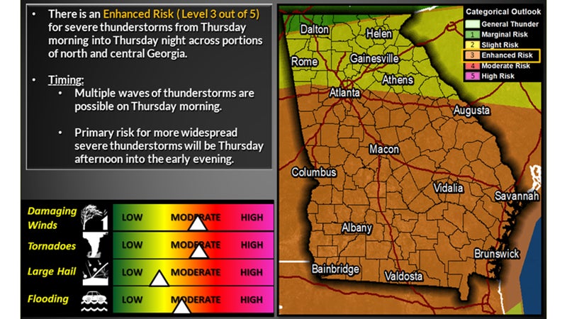
Another round of severe storms is expected to pass through Troup County beginning Thursday morning and again Thursday afternoon.
According to National Weather Service Meteorologist Nick Morgan, this is a fairly tricky forecast.
“Right now, it seems that all the threats are still in play,” Morgan said. “There is a severe weather threat with 10 percent (chance of) tornadoes, and some of those could be severe. Looking at hail probabilities, that is also up there but not as big a chance at around a 15% chance.”
Troup County is included in the NWS’ enhanced area, which is three out of five on the severe weather scale. The enhanced risk goes north into the Atlanta metro area and covers everything south. Northern areas of Georgia are under a slight risk for severe weather and a sliver of northwest Georgia is under a marginal risk.
Along with tornadoes and hail, damaging winds are also possible with Thursday’s storms.
“Things could change as we get a new update,” Morgan said.
Morgan said it’s hard to tell how Thursday’s weather compares to the storm systems from the last few weekends.
“The models are kind of having a difficulty just resolving the environment right now,” Morgan said. “So, it’s kind of hard to really compare it to another storm system. What I can tell you though is, it is looking like a severe situation.”
